|
| Shag in a tree |
The next leg of my trip to the South island involved hiring an orange car and driving it to a wee town called Motueka, and a delightful AirBnB owned by a sound chap called Dave, with all manner of people coming and going, and very hospitable. Actually felt like a home rather than just a place to crash. From here, it was a short drive to go kayaking in Abel Tasman, and a rather longer drive to visit the Farewell Spit.
First up, the kayaking. Flush with the success of pioneering my very own kayaking technique that I've christened the Richie Row (see part 44), I was eager to try it out again to see if it made my arms any less sore.
Abel Tasman (he of Tasmania fame) National Park is made up of sandy beaches
and well-maintained tracks. After the usual safety briefings, we set off with
so much wind behind us that we barely had to paddle, and we arrived at our
destination in record time (or it could have just been my superior rowing
technique).
When we arrived, I left all my soaking wet kayaking clothing for the poor sap doing the return kayak into the wind. There are also lots of flightless birds called Weka wandering about, taking a keen interest in what you're having for your lunch.

|
| A silver fern (looks more green to me) |

|
| View from the Abel Tasman trek |

|
| Tim, Judi, and me at the end of the walk |
The next day's journey to the Farewell Spit wasn't a straightforward one. First, there was a 100km drive - much of it over a very windy mountain road. Still, there were plenty more nice views to be had.

|
| A lookout en route to the Spit |
The tiny town of Collingwood serves as the starting point for the trip. We all hopped on the bus and set off ...

|
Our tour guide was probably the best I've had over the last eight months, and was very well-informed and clear.

|
|
Old Man Rock. And for once it actually looks like the thing it's
named after. |
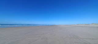
The Farewell Spit is a 20 mile long, narrow "spit" of sand on the far north of the South island.

|

|
| Miles and miles of miles of sand |
It is also the location of Wharariki beach, which will be recognisable to anyone with a Windows PC.

|
| Not my photo! I guess it belongs to Bill Gates. |
The first stop was Farewell Point, the further north point of the South island. It was named "Farewell" by Captain Cook, and it had some spectacular yet crumbly cliffs, and we were warned not to go anywhere near the cliff edge.

|
| But I don't play by the rules |
Next stop was Fossil Point where I was too busy getting dive-bombed by territorial oyster-catchers to take any decent photos.
The highlight of the tour was the lighthouse near the end of the Spit. The lighthouse itself is on stilts to make it visible far out at sea. The spit itself is getting larger, so now the lighthouse is some 300m inland.

|
| Farewell Spit lighthouse |
Around a hundred years ago, the lighthouse keeper and his family were fed up with digging their house out the sand, so they brought back a couple of bags of soil after each visit to the mainland and gradually built a wee oasis at the end of the spit.

|
| A dead whale and signpost (sadly without miles/kilometres) |

|
| Do you take Google Pay? |
At this point, it was past 7pm and the tide was rising, so we bombed it back up the spit - stopping off at some dunes to fill up my shoes with sand, and also to take photos of seals in the distance.

|
| Another fine photograph |
Because the tour didn't set off till 3pm, it was past 9pm when we got back, and nearly 11pm by the time I got back to Motueka. However, it was worth it, and definitely one of the best trips I've been on in the last eight months.
Next stop, take the orangemobile back and get the bus to Kaikoura.
Comments